IPTC tags:
▪ Iptc.By-line:
Patrick Brown
▪ Iptc.Country/Primary Location:
USA
▪ Iptc.Directory Version:
2
▪ Iptc.Copyright Notice:
© Patrick Brown 2010
▪ Iptc.Writer/Editor:
Patrick Brown
▪ Iptc.Caption/Abstract:
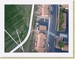
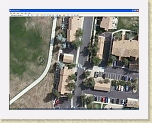
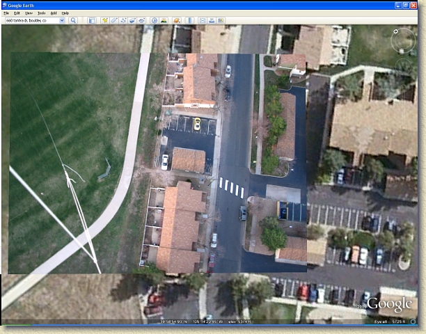
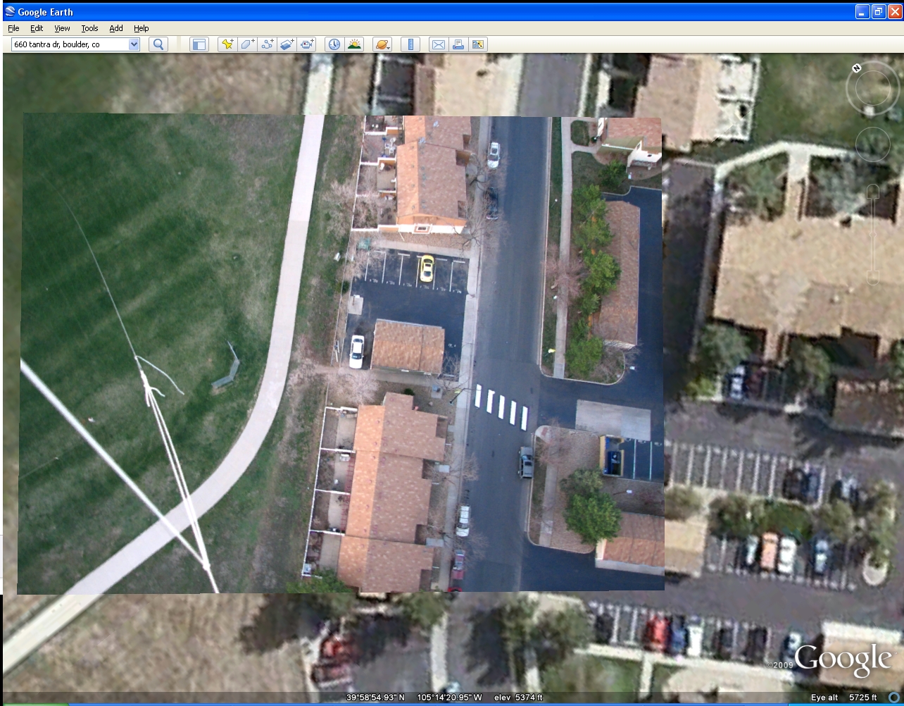
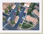
Top-down photo shown overlayed in Google Earth to demonstrate much higher resolution that is possible with near earth aerial photography
▪ Iptc.Province/State:
CO
▪ Iptc.City:
Boulder
▪ Iptc.Object Name:
First Tethered Balloon Flight with Remote Gimbaled Camera System
JPEG tags:
▪ Jpeg.Number of Components:
3
▪ Jpeg.Image Height:
1002 pixels
▪ Jpeg.Data Precision:
8 bits
▪ Jpeg.Image Width:
1284 pixels
▪ Jpeg.Component 1:
Y component: Quantization table 0, Sampling factors 2 horiz/2 vert
▪ Jpeg.Component 2:
Cb component: Quantization table 1, Sampling factors 1 horiz/1 vert
▪ Jpeg.Component 3:
Cr component: Quantization table 1, Sampling factors 1 horiz/1 vert
TetheredBalloon
»
Viewing
IMG_1624_GE
[Image 27 of 43]
::
Jump To
- Page 1
- Page 2
- Page 3
Comment:
Top-down photo shown overlayed in Google Earth to demonstrate much higher resolution that is possible with near earth aerial photography
First Tethered Balloon Flight with Remote Gimbaled Camera System
Boulder - CO - USA
IMG_1624_GE.JPG - 1284 x 1002 - (867KB) - © Patrick Brown 2010
Patrick Brown
Album last updated on 4/21/10 11:18 PM
Powered by
Jalbum 8.3
and
BluPlusPlus
skin