|
| ▪ Model: | | Canon PowerShot S3 IS |
| ▪ Metering Mode: | | Multi-segment |
| ▪ User Comment: | | |
| ▪ F-Number: | | F2.7 |
| ▪ YCbCr Positioning: | | Center of pixel array |
| ▪ Compressed Bits Per Pixel: | | 5 bits/pixel |
| ▪ Exif Image Height: | | 2112 pixels |
| ▪ Focal Length: | | 6.0 mm |
| ▪ Thumbnail Data: | | [5349 bytes of thumbnail data] |
| ▪ Make: | | Canon |
| ▪ Date/Time Original: | | 2010:04:14 18:17:40 |
| ▪ Scene Capture Type: | | Standard |
| ▪ Exif Image Width: | | 2816 pixels |
| ▪ Focal Plane X Resolution: | | 45/563200 inches |
| ▪ White Balance: | | Auto white balance |
| ▪ Focal Plane Resolution Unit: | | Inches |
| ▪ Aperture Value: | | F2.7 |
| ▪ Orientation: | | Top, left side (Horizontal / normal) |
| ▪ Exposure Time: | | 1/60 sec |
| ▪ FlashPix Version: | | 1.00 |
| ▪ Custom Rendered: | | Normal process |
| ▪ Digital Zoom Ratio: | | 1 |
| ▪ Y Resolution: | | 180 dots per inch |
| ▪ Exposure Mode: | | Auto exposure |
| ▪ Exif Version: | | 2.20 |
| ▪ Sensing Method: | | One-chip color area sensor |
| ▪ X Resolution: | | 180 dots per inch |
| ▪ Shutter Speed Value: | | 1/59 sec |
| ▪ Color Space: | | sRGB |
| ▪ Components Configuration: | | YCbCr |
| ▪ Max Aperture Value: | | F2.7 |
| ▪ Thumbnail Offset: | | 5108 bytes |
| ▪ Thumbnail Length: | | 5349 bytes |
| ▪ Exposure Bias Value: | | 0 EV |
| ▪ Flash: | | Flash did not fire, auto, red-eye reduction |
| ▪ Focal Plane Y Resolution: | | 169/2112000 inches |
| ▪ Date/Time Digitized: | | 2010:04:14 18:17:40 |
| ▪ Resolution Unit: | | Inch |
| ▪ Compression: | | JPEG (old-style) |
| ▪ Date/Time: | | 2010:04:14 18:17:40 |
| ▪ File Source: | | Digital Still Camera (DSC) |
|
| ▪ Canon Makernote.Unknown tag (0xc201): | | 26 |
| ▪ Canon Makernote.Unknown tag (0xc221): | | 0 |
| ▪ Canon Makernote.Focus Mode: | | Continuous |
| ▪ Canon Makernote.White Balance: | | Auto |
| ▪ Canon Makernote.Owner Name: | | |
| ▪ Canon Makernote.Unknown tag (0xc21b): | | 0 |
| ▪ Canon Makernote.Flash Details: | | Unknown (0) |
| ▪ Canon Makernote.Unknown tag (0x001d): | | 32 1 12 2 2 2 2 0 0 0 0 47 0 0 0 0 |
| ▪ Canon Makernote.Image Number: | | 1001637 |
| ▪ Canon Makernote.Unknown tag (0xc219): | | 0 |
| ▪ Canon Makernote.Unknown tag (0xc20b): | | 0 |
| ▪ Canon Makernote.Unknown tag (0x0003): | | 0 0 0 0 |
| ▪ Canon Makernote.Unknown tag (0xc125): | | 2816 |
| ▪ Canon Makernote.Unknown tag (0xc202): | | 160 |
| ▪ Canon Makernote.Unknown tag (0x0010): | | 26542080 |
| ▪ Canon Makernote.Unknown tag (0xc21a): | | 250 |
| ▪ Canon Makernote.Unknown tag (0xc212): | | 3 |
| ▪ Canon Makernote.Unknown tag (0x001e): | | 16777472 |
| ▪ Canon Makernote.Unknown Camera State 2: | | 0 |
| ▪ Canon Makernote.Unknown tag (0x0004): | | 68 26 160 123 92 189 0 0 0 0 0 0 0 0 0 0 0 0 3 6553 0 94 192 0 0 0 250 0 0 0 0 0 0 0 |
| ▪ Canon Makernote.Unknown Camera State 13: | | 0 |
| ▪ Canon Makernote.Unknown tag (0x0018): | | 0 0 0 0 0 0 0 0 0 0 0 0 0 0 0 0 0 0 0 0 0 0 0 0 0 0 0 0 0 0 0 0 0 0 0 0 0 0 0 0 0 0 0 0 0 0 0 0 0 0 0 0 0 0 0 0 0 0 0 0 0 0 0 0 0 0 0 0 0 0 0 0 0 0 0 0 0 0 0 0 0 0 0 0 0 0 0 0 0 0 0 0 0 0 0 0 0 0 0 0 0 0 0 0 0 0 0 0 0 0 0 0 0 0 0 0 0 0 0 0 0 0 0 0 0 0 0 0 0 0 0 0 0 0 0 0 0 0 0 0 0 0 0 0 0 0 0 0 0 0 0 0 0 0 0 0 0 0 0 0 0 0 0 0 0 0 0 0 0 0 0 0 0 0 0 0 0 0 0 0 0 0 0 0 0 0 0 0 0 0 0 0 0 0 0 0 0 0 0 0 0 0 0 0 0 0 0 0 0 0 0 0 0 0 0 0 0 0 0 0 0 0 0 0 0 0 0 0 0 0 0 0 0 0 0 0 0 0 0 0 0 0 0 0 0 0 0 0 0 0 0 0 0 0 0 0 |
| ▪ Canon Makernote.Unknown tag (0xc20a): | | 0 |
| ▪ Canon Makernote.Unknown Camera State 12: | | 0 |
| ▪ Canon Makernote.Unknown Camera State 3: | | 65535 |
| ▪ Canon Makernote.Digital Zoom: | | No digital zoom |
| ▪ Canon Makernote.Unknown Camera State 4: | | 1 |
| ▪ Canon Makernote.Unknown Camera State 9: | | 92 |
| ▪ Canon Makernote.Unknown Camera State 7: | | 32767 |
| ▪ Canon Makernote.Unknown Camera State 8: | | 65535 |
| ▪ Canon Makernote.Unknown Camera State 10: | | 192 |
| ▪ Canon Makernote.Unknown tag (0xc124): | | 2816 |
| ▪ Canon Makernote.Flash Activity: | | Unknown (65535) |
| ▪ Canon Makernote.Unknown tag (0xc12c): | | 0 |
| ▪ Canon Makernote.Unknown tag (0xc12b): | | 32767 |
| ▪ Canon Makernote.Self Timer Delay: | | Self timer not used |
| ▪ Canon Makernote.AEB Bracket Value: | | 0 |
| ▪ Canon Makernote.AF Point Used: | | Right |
| ▪ Canon Makernote.Unknown tag (0xc123): | | 27 |
| ▪ Canon Makernote.Unknown tag (0xc20d): | | 0 |
| ▪ Canon Makernote.Unknown tag (0xc220): | | 0 |
| ▪ Canon Makernote.Unknown tag (0xc122): | | 2 |
| ▪ Canon Makernote.Makernote Unknown 1: | | 0 1 0 369 0 0 0 0 0 0 9 10 369 369 283 629 -60 0 3 369 490 489 480 0 0 0 0 0 0 0 0 0 0 141 -243 202 0 0 0 0 0 0 640 0 -244 200 0 0 -7159308 0 1080 1040 1063 1328 -242 200 121 937 1914 1523 937 1 627 283 369 603 -60 2 0 1 0 0 0 0 2864 5 0 0 0 0 0 0 2800 2828 9143 0 1 0 26936 3 1 2713 25 7 -1755117504 65535 |
| ▪ Canon Makernote.Unknown tag (0xc214): | | 0 |
| ▪ Canon Makernote.Iso: | | Auto |
| ▪ Canon Makernote.Unknown tag (0x001c): | | 0 |
| ▪ Canon Makernote.Unknown tag (0xc12a): | | 32767 |
| ▪ Canon Makernote.Long Focal Length: | | 7200 100 |
| ▪ Canon Makernote.Metering Mode: | | Evaluative |
| ▪ Canon Makernote.Unknown tag (0xc208): | | 0 |
| ▪ Canon Makernote.Easy Shooting Mode: | | Manual |
| ▪ Canon Makernote.Unknown tag (0xc20c): | | 0 |
| ▪ Canon Makernote.Unknown tag (0xc21f): | | 0 |
| ▪ Canon Makernote.Flash Mode: | | No flash fired |
| ▪ Canon Makernote.Unknown tag (0xc215): | | 94 |
| ▪ Canon Makernote.Saturation: | | Normal |
| ▪ Canon Makernote.Unknown tag (0xc129): | | 0 |
| ▪ Canon Makernote.Unknown tag (0xc12d): | | 0 |
| ▪ Canon Makernote.Unknown tag (0x0022): | | 416 0 0 16 8 1 1 640 480 0 0 0 0 0 8 384 0 0 0 0 0 0 0 0 0 0 0 0 0 0 0 0 0 0 0 0 0 0 0 0 0 0 0 0 0 0 0 0 0 0 0 0 0 0 0 0 0 0 0 0 0 0 0 0 0 0 0 0 0 0 0 0 0 0 0 0 0 0 0 0 0 0 0 0 0 0 0 0 0 0 0 0 0 0 0 0 0 0 0 0 0 0 0 0 0 0 0 0 0 0 0 0 0 0 0 0 0 0 0 0 0 0 0 0 0 0 0 0 0 0 0 0 0 0 0 0 0 0 0 0 0 0 0 0 0 0 0 0 0 0 0 0 0 0 0 0 0 0 0 0 0 0 0 0 0 0 0 0 0 0 0 0 0 0 0 0 0 0 0 0 0 0 0 0 0 0 0 0 0 0 0 0 0 0 0 0 0 0 0 0 0 0 0 0 0 0 0 0 |
| ▪ Canon Makernote.Unknown tag (0x0013): | | 0 0 0 0 |
| ▪ Canon Makernote.Quality: | | Superfine |
| ▪ Canon Makernote.Unknown tag (0xc205): | | 189 |
| ▪ Canon Makernote.Unknown tag (0xc21e): | | 0 |
| ▪ Canon Makernote.Sharpness: | | Normal |
| ▪ Canon Makernote.Unknown tag (0x001a): | | 0 |
| ▪ Canon Makernote.Image Size: | | Large |
| ▪ Canon Makernote.Exposure Mode: | | Program |
| ▪ Canon Makernote.Unknown tag (0xc216): | | 192 |
| ▪ Canon Makernote.Unknown tag (0xc128): | | 65535 |
| ▪ Canon Makernote.Unknown tag (0x0000): | | 0 0 0 0 0 0 0 0 0 |
| ▪ Canon Makernote.Focal Units per mm: | | 100 |
| ▪ Canon Makernote.Unknown tag (0xc206): | | 0 |
| ▪ Canon Makernote.Unknown tag (0xc21d): | | 0 |
| ▪ Canon Makernote.Contrast: | | Normal |
| ▪ Canon Makernote.Flash Bias: | | 0.0 EV |
| ▪ Canon Makernote.AF Point Selected: | | Unknown (8197) |
| ▪ Canon Makernote.Unknown tag (0x0001): | | 92 2 0 5 0 0 0 4 65535 1 0 1 0 0 0 0 15 3 1 8197 1 32767 65535 7200 600 100 92 192 65535 0 0 0 1 0 2 27 2816 2816 0 0 65535 0 32767 32767 0 0 |
| ▪ Canon Makernote.Unknown tag (0xc217): | | 0 |
| ▪ Canon Makernote.Continuous Drive Mode: | | Single shot |
| ▪ Canon Makernote.Unknown tag (0xc127): | | 0 |
| ▪ Canon Makernote.Firmware Version: | | Firmware Version 1.00 |
| ▪ Canon Makernote.Auto Exposure Bracketing: | | 0 |
| ▪ Canon Makernote.Unknown tag (0xc203): | | 123 |
| ▪ Canon Makernote.Unknown tag (0x001f): | | 138 1 0 4 8 0 0 0 0 0 0 0 0 0 0 0 0 0 0 0 0 0 0 0 0 0 0 0 0 0 0 0 0 0 0 0 0 0 0 0 0 0 0 0 0 0 0 0 0 0 0 0 0 0 0 0 0 0 0 0 0 0 0 0 0 0 0 0 0 |
| ▪ Canon Makernote.Unknown tag (0x0019): | | 1 |
| ▪ Canon Makernote.Unknown tag (0xc21c): | | 0 |
| ▪ Canon Makernote.Image Type: | | IMG:PowerShot S3 IS JPEG |
| ▪ Canon Makernote.Unknown tag (0xc126): | | 0 |
| ▪ Canon Makernote.Subject Distance: | | 6553 |
| ▪ Canon Makernote.Short Focal Length: | | 600 100 |
| ▪ Canon Makernote.Unknown tag (0x0002): | | 2 600 230 173 |
| ▪ Canon Makernote.Unknown tag (0xc121): | | 0 |
| ▪ Canon Makernote.Unknown tag (0xc218): | | 0 |
| ▪ Canon Makernote.Unknown tag (0xc204): | | 92 |
| ▪ Canon Makernote.Sequence Number: | | 0 |
| ▪ Canon Makernote.Macro Mode: | | Normal |
| ▪ Canon Makernote.Focus Type: | | Auto |
| ▪ Canon Makernote.Unknown tag (0x0012): | | 1 1 2816 2112 1408 264 253 48 0 0 1 0 |
|
| ▪ Iptc.Writer/Editor: | | Patrick Brown |
| ▪ Iptc.Country/Primary Location: | | USA |
| ▪ Iptc.By-line: | | Patrick Brown |
| ▪ Iptc.Copyright Notice: | | © Patrick Brown 2010 |
| ▪ Iptc.Province/State: | | CO |
| ▪ Iptc.Time Created: | | 181740-0600 |
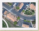
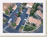
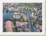
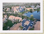
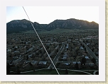
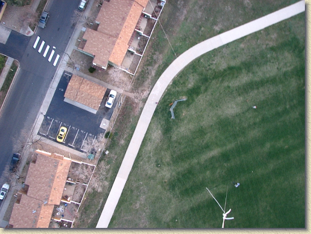
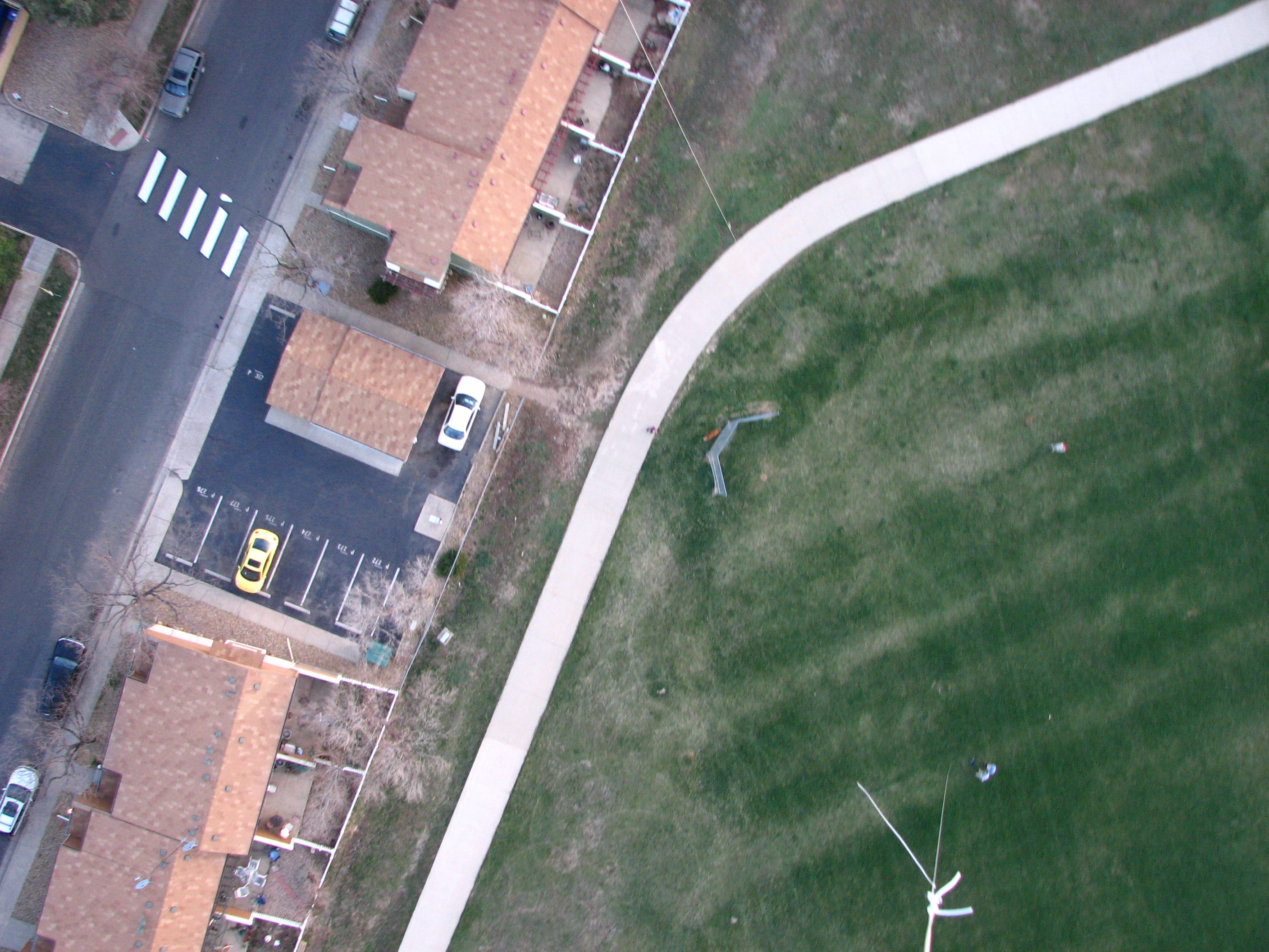
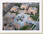
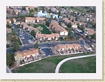
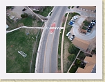
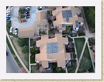
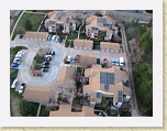
| ▪ Iptc.Caption/Abstract: | | Abstraction from a balloon |
| ▪ Iptc.City: | | Boulder |
| ▪ Iptc.Object Name: | | First Tethered Balloon Flight with Remote Gimbaled Camera System |
| ▪ Iptc.Directory Version: | | 2 |
| ▪ Iptc.Date Created: | | Wed Apr 14 00:00:00 MDT 2010 |
|
| ▪ Jpeg.Data Precision: | | 8 bits |
| ▪ Jpeg.Component 1: | | Y component: Quantization table 0, Sampling factors 1 horiz/2 vert |
| ▪ Jpeg.Component 2: | | Cb component: Quantization table 1, Sampling factors 1 horiz/1 vert |
| ▪ Jpeg.Component 3: | | Cr component: Quantization table 1, Sampling factors 1 horiz/1 vert |
| ▪ Jpeg.Image Width: | | 2816 pixels |
| ▪ Jpeg.Number of Components: | | 3 |
| ▪ Jpeg.Image Height: | | 2112 pixels |